


Updated: Apr 1

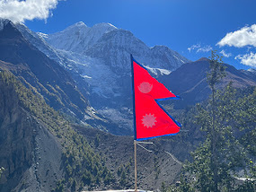
Hiking around the Annapurna Circuit is what is commonly known as ‘teahouse trekking’. It follows a well-established trail which passes through many small villages with teahouses (or guest houses), which are hosted by local families welcoming trekkers with meals and accommodation. Over the past 40 or so years, the Circuit has gradually become more commercial, with a road now extending as far as the town of Manang, meaning some trekkers take a jeep along the treacherous mountain "road" straight up from 800 metres to the dangerous elevation of 3,519 metres. Many of these people suffer the debilitating effects of Altitude Mountain Sickness (AMS) due to the lack of acclimatisation. When venturing above 3,000 metres, it is recommended to ascend slowly/gradually, which is how it was done historically before the road. By comparison, the tallest mountain in New Zealand is 3,724 metres, so this was new territory for us and we weren't going to take any unnecessary risks! We would walk the trail over 6 days to reach this same point that the road reaches. Many of the small towns we passed through have had consistently dwindling numbers of guests since the road developments, impacts of covid, and increase in shorter guided tours which bypass the earlier villages, so this was further incentive to take the long road.
There are many variations on how to hike the Annapurna Circuit, including start/finish points, duration, and guided/unguided, etc. Trekking agencies can easily arrange everything for you, or you can hire a guide and/or porter yourself and take the risk of getting a decent experience one, or you can ‘DIY’, which is the option we chose. We felt prepared from our research and previous long hiking trips that we had the knowledge and resources to safely make this journey, and felt confident enough to make the decision to turn around if the altitude/injury/weather conditions required along the way.
While October & November are considered the peak season and best months to trek as the summer monsoon should have finished and skies should be clear, the weather can be unpredictable, and the impacts of climate change mean that the seasons no longer fall in the same routine as in the past. It was October 1st as we set out on the trail, and it was hot, muggy and cloudy.
Day 1: Pokhara to Besi Sahar to Nadi - 11.5km (7mi)
It absolutely poured with rain through the night, as a strong thunderstorm hit the region. This seems to happen quite often to us before we head out for a long hike! The bus from Pokhara to Besi Sahar was far more rugged and local than our lovely air conditioned one from Kathmandu, but we were grateful to have allocated seats as it was very quickly standing room only. We were informed to be at the bus station at 6am, but the bus ended up departing closer to 7am. Our packs were tied to the roof and we were feeling anxious about this, hoping both the packs and ourselves would safely make the journey along the dusty, bumpy road. We were anticipating it might take 5-8 hours to travel the 106km / 65mi , and were relieved to arrive in Besi Sahar in just 6 hours. The rain held off, and we were happy to get some hiking in during day 1.
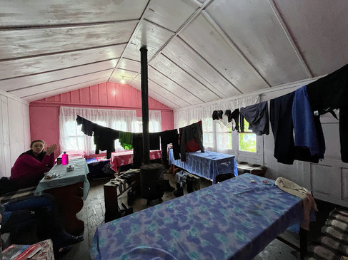
We only hiked 10km, but it was a heck of a day with the heat really getting to us, and it was a relief to arrive at a series of guest houses just before the village of Nadi. We arrived at a similar time as a French couple from our bus ride, and we had our eyes set on the Hilton Hotel. After taking a look at the rooms and bathrooms, we decided against the Hilton and settled on the ‘Peace Full Hotel’ instead, which was run by a lovely family with 3 daughters keen to practise their English and play with Jelley’s rings. A neighbouring guest house had quite the operation going on, and with the owner giving out his business card at the bus stop in Besi Sahar, promising free accommodation when buying meals, before he took the jeep to his teahouse in Nadi to then greet the same people on their arrival to the town. He swiftly captured the majority of the independent trekkers, which meant our Peace Full hotel was indeed peaceful and quiet.
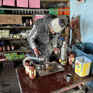
We didn’t see the mountain range all day, as it was enshrouded in cloud, but we had plenty of time and knew it would be waiting for us. We had our first Dal Baht for dinner, which is a lentil curry popular in Nepal (most locals have it twice a day!) and comes with unlimited refills of rice, lentil curry and vegetables. The saying goes on the Annapurna Circuit “Dal Baht Power for 24 Hour”, referring to the energy you can store from filling yourself with the food. It was a bit much for Jelley, but Luke loved it and it became a staple meal during our time in Nepal.
Day 2: Nadi to Jagat - 18.8km (11.6mi)
We woke at 3am to another thunderstorm and consistent rain. We had decided the night before to arrange breakfast for 7am and hit the trail shortly after, but we were quickly rethinking our start time. It’s hard to motivate yourself to get out of bed with rain pouring on the tin roof!
We were feeling a little bit deflated after how shattered we felt during the day prior’s walk, with initial regret at bringing our sleeping bags and such warm clothes in our packs - they felt so heavy in the heat. It was hard to imagine that we would be cold in one week’s time! Our disappointment at the rain turned to gratitude as the temperature remained far cooler throughout the whole day, and rain became constant light drizzle. We soon met a cool young American couple, just 22, taking a gap year from college to travel. They had been living in Israel for the last couple of years. They were great company, and we really enjoyed the day together chatting about life as Americans abroad.
The day was filled with towering waterfalls, sketchy suspension bridges, a hydro dam and our first encounter with leeches. Leeches are odd creatures who wriggle their way with ease through boots and socks to attach themselves to your skin and drink your blood (yuck!). They don’t hurt, but they do cause a huge amount of bleeding because their saliva is an anticoagulant (prevents your blood from clotting) and makes any bite bleed continuously. Luke was fascinated by them, and they were equally as fascinated by Luke.
The second half of the day was spent hiking along the road, although you could hardly call it a road at times! There were off-road trails we could have taken, but with the promise of more leeches and muddy paths from the rain, we decided to stick with the road and wave at the jeeps as they passed. We did try one suggested short-cut trail from our map, but ended up in the backyard of someone’s house and he quickly showed us in the right direction. We suspect we weren’t the first and wouldn’t be the last to do this, as he didn’t seem overly surprised to see us.
We passed lots of cute villages with even cuter kids in their school uniforms, yelling out ‘namaste’ and ‘goodbye’ as we passed. Landslides are super common across Nepal, especially with the monsoon rains, and one section of the road was completely wiped out on the side of the river we were on. The hiking trail was close to a steep cliff, and we could think of several friends who wouldn’t be comfortable in this situation. Today brought us 923metres of uphill elevation gain - some serious uphill! We ended the day at 1,369metres but we still had a longgg way to go with the Thorong La pass at 5,400metres!
We made good pace, and after our sluggish day 1, we thought we might only make it to Ghermu on day 2. We were feeling good enough to continue for 18.5km to Jagat, and arrived just before 1pm. Our young American friends decided to keep walking, they had far more energy than us, and we suspected this might be the last time we saw them on the trail!
We settled in at the ‘North Face Hotel’ - they clearly ripped off the clothing brand’s logo and obviously had no association with them - this is quite a common practice in Asian countries. They often call the clothing items here the ‘North Fake’. It was a great spot with views of the gorge, and a nice room with attached bathroom, It still felt like 'off-season' and had been quiet on the trail, we saw just 10 other hikers all day, but we thought this may change the closer we got to Manang, when those taking the jeeps joined the trail.
Day 3: Jagat to Dharapani - 21km (13mi)
We employed a similar strategy today, with two potential end-destinations dependent on trail conditions, weather, and how we were feeling. The first option was to finish in Tal, and the second to continue further to either Karte or Dharapani, which would make day 3 longer but shave off time and distance from day 4.
We encountered more leeches today, who particularly liked Luke’s Californian blood. The trail was off the road, and involved a lot of uphill steep steps. We were pleasantly surprised to reach the town of Tal at 11am, with plenty of hours left in the day. It was a beautiful town right by the riverside, which had unfortunately been washed away by a flood 2 years prior. This wasn’t entirely surprising due to its precarious location. Initially we had planned to just have a hearty breakfast in the morning, snack throughout the day, and have dinner when we reached our home for the night, but we treated ourselves to lunch today in Tal. We had a pumpkin, potato & bean soup with locally grown vegetables, and an apple pie (the first of many)! It was delicious and we had absolutely no regrets.
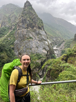
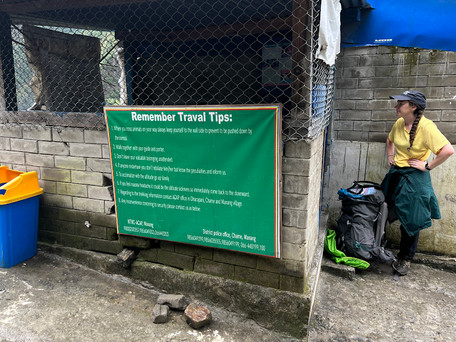
After a quick stop at the Tal waterfall (a theme for the day!), we continued on along the road, as a bridge had washed out further along the hiking trail. While there were a few jeeps wrestling on the narrow road and showing off their impressive manoeuvring skills to get past each other along the way, it didn’t feel too busy and didn’t detract from our hiking experience. We encountered our first permit checkpoint, with the guards seeming entirely disinterested, and continued along our way. The drizzle turned to heavier rain as we trudged on, determined to reach Dharapani for the night. We encountered a couple of small groups with guides and porters, and were blown away by the size of the loads being carried by porters, and their way of carrying them. It was often 2 large duffel bags tied together with rope and a backpack on top, then carried by a band that went around their foreheads instead of any straps on their backs. Jaw-dropping strength & endurance.
Wet and tired after 21km, we were happy to reach our home for the night, and even happier to discover they had hot water for a shower! It was noticeably cooler here already at 1,860m, and we used our sleeping bags for the first time and were grateful to put on a set of warm, dry clothes.
Day 4: Dharapani to Timang - 8.5km (5mi)
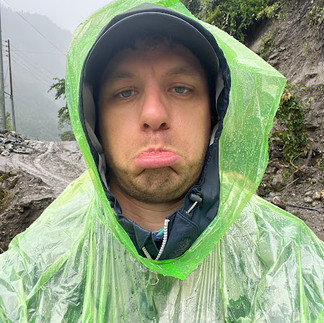
The rain continued to bucket down overnight, and we had a ‘sleep in’ until 7.30am, hoping the weather would subside. It seemed to get heavier, and we assessed our options. The online forecast suggested the downpour would turn to drizzle around midday, and we decided to wait it out for the morning, and shorten our 5-6 hour day to Chame to just 3-4 hours to Timang instead.
Around 11am, rain showed no sign of letting up, and we reluctantly got dressed to brave the elements in our rain ponchos. The trail notes promised incredible views during this section, but none were to be seen through the thick rain. It was a steep climb to Timang and the trail was muddy and very wet. We were soon walking up gushing water, and came across 2 impromptu waterfalls we had no choice but to cross. Eventually we made our way from the trail to the ‘jeep road’, which had also transformed into a river but was a little more stable underfoot and felt marginally safer than the track.
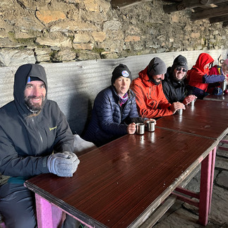
We were relieved to reach Timang - a small community that most trekkers just stop in for lunch. It is famed for brilliant views of the 8th highest mountain in the world, Manaslu, but there was no such luck for us when we arrived! We were satisfied with a hot shower and a fireplace to dry out our soaking wet clothes from the past 2 days. We were really grateful to have the flexibility to break up the journey and make decisions based on the weather - other larger tour groups had to continue on another 3 hours to their pre-booked accommodation for the night. There were only 2 other guests staying here with us tonight - Sebastian & Sebastian, friends from a small town in Germany. Little did we know at the time, but we would soon be spending a lot of time with the Sebastians!
The rain finally began to clear around sunset, and when Jelley woke up at 3am and popped outside, the skies were clear enough to see the stars and mountains surrounding us. It was an amazing sight!
Day 5: Timang to Upper Pisang - 21.8km (13mi)
We woke to blue sky and sun rays, and could finally see all of the glory around us. Everything seemed to shine a little brighter today after the rain. We had quite a big day ahead today if we were to reach Upper Pisang, and got moving before 7.30am. Jelley’s boots hadn’t quite dried, but the rest of our gear had and we were very thankful for that.
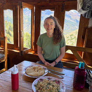
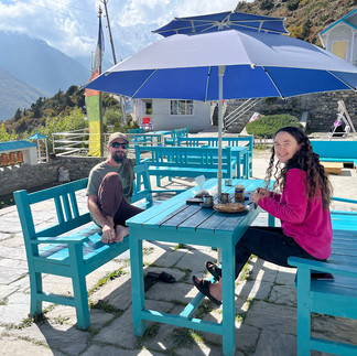
The trail snaked through pine tree forests, around recent landslides and up and down valleys. We passed through the towns of Koto and Chame, before being greeted with the strange sight of apple orchards lining the ‘streets’. Our lunch destination was called the ‘Farmhouse’, a beautiful American-style lodge which felt out of place given our recent accommodations, and the location, which felt like the middle of nowhere after 5 days of trekking. It was located right next door to the brand new Manang Valley winery. The Farmhouse was famous for their apple donuts, but unfortunately a large group had just eaten the day’s supply, and we had to settle for apple crumble instead. It was nice to put our feet up and relax in the comfortable surroundings before continuing for the final 9km to Upper Pisang.
The day seemed to take forever, but eventually we reached Upper Pisang, and on our arrival saw a trekker from our stay in Dharapani, Mario from Germany. He was chilling on a rooftop with an incredible view, and convinced us to stay at the colourful but busy guesthouse. It was great to catch up on the past couple of days trekking and hearing how he also navigated the wild weather.
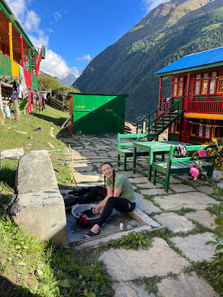
We spent the evening soaking in the views of Annapurna II (7,397m / 26,040ft - 16th tallest in the world) which was on full display from the rooftop platform of our guesthouse. There was also an attempt at doing some laundry by hand, but it wasn't all that successful. Later on, our Sebastian friends showed up at the same accommodation (apparently this was the place to be!) and we all enjoyed dinner together with Jelley braving a Nepalese pizza topped with yak cheese and potatoes (yum!).
Day 6: Upper Pisang to Manang - 21.2km (13mi)
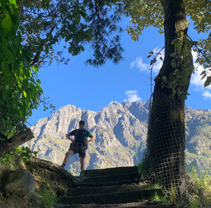
We hit the trail a little later this morning, shortly after 8am, and got caught behind a huge group of 35 Indian doctors! They were really interesting characters and great to chat to, but we were keen to overtake and have a little more solitude for the day. There were 2 trail options for today, a higher, more challenging route, or an easier route along the road and valley floor. We had no excuse not to take the high route, and didn’t regret the decision at all
We were finally reaching a higher altitude, and knew we needed to take it a little slower today, as we were feeling the heavy breathing a little more than other days. Gharyu offered unbelievable views, which continued throughout the day. We stopped at Nga Wal for lunch at a cute teahouse, before continuing along the sunny and exposed track all the way to Manang.
Manang is the main hub town for the region, and the current ‘end of the road’ for jeeps driving in. Situated at 3,529 metres, it was a good resting point to adjust to the increase in elevation, and is also home to various bakeries, shops and essentials for trekkers.
We had tried to book a hotel with good reviews, but arrived to find they were full and had to settle for another recommendation up the road. We were happy with our sunny room and hot shower, and the only downside of this accommodation was that every other guest there seemed to have a cold or other illness. One of the caveats of staying in teahouses in these treks, is that often your room charge ranges from $0 to $5 per night, but in exchange you have to eat breakfast and dinner there, so we had no choice but to eat in the common area with the other sick trekkers. It was nice to chat to a couple of Kiwi nurses, and other Australians we had run into earlier in the trip, but we did try to keep our distance from most other guests, eager to avoid a respiratory illness.
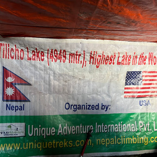
We were happy to have 2 nights in one spot, and had time to now plan the next stage of our trek. Luckily the weather forecast was looking promising over the next week, and we investigated the option of a detour from the Annapurna Circuit to the ‘highest’ mountain lake in the world, Tilicho Lake.
Day 7: Zero Day in Manang - Jelley 0km , Luke 16km (10mi)
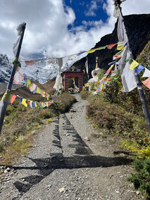
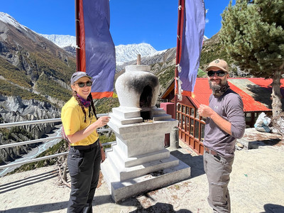
It was time for our first (and only) rest day of the trek! By ‘rest day’ it was actually meant to be an acclimatisation day, during which it is recommended to trek to a higher elevation then sleep lower again. Jelley was battling with blisters, so took her Kindle to a bakery to chill and read in the sun, while Luke went off on a fun solo adventure up to Milarepa’s Cave. Although, the cave was inaccessible (ropes and climbing gear required), hiking up to the top of the hill did offer some sweeping views of the valley and a gorgeous Buddhist Monastery to see.
In the afternoon, we went along to the Himalayan Rescue Association’s free daily talk on AMS (Altitude Mountain Sickness). A small cohort of volunteer Nepalese & international doctors volunteer for 8 weeks a year during the peak tourist season at a medical clinic outpost in Manang, and another in a more remote part of the Everest region. They provide free advice on AMS to trekkers, offer medical treatment to foreigners for a small cost of $40, which in turn funds free healthcare services for the local Nepalese community, who otherwise don’t have access to healthcare. A great system!
The British doctor leading the talk was an entertaining character, and reconfirmed the knowledge we had about the signs and symptoms of AMS including what to do in more severe cases of High Altitude Pulmonary Edema (HAPE) and High Altitude Cerebral Edema (HACE). Short answer, descend! We also took our blood oxygen readings (which the doctor said is more of an interesting gimmick than indication of how well you are acclimatising), and bought a cool beanie to support the cause.
The German guys we had met earlier in the week, Sebastian, Sebastian & Mario, were also at the HRA talk, and after discussing our newly formed plans from Jelley’s research on Tilicho Lake, we decided to team up and form a crew to hike this next section together. Safety in numbers!
Day 8: Manang to Shree Kharka - 11km (6.8mi)
It was time to leave the comforts of Manang, and head to our next stop on the journey, Shree Kharka. We had opted for a shorter 3 hour walk today, rather than a 6-7 hour day through to Tilicho base camp hotel, to aid in acclimatisation and tackle the track to base camp in the calmer morning conditions the next day.
It was a relatively easy walk up the valley, and shortly before our destination we reached a beautiful 700 year old monastery. We were glad we stopped where we did, it was a gorgeous spot and we made an incense offering to request safe passage for the journey ahead.
We enjoyed a chilled afternoon , catching up with many of those we had met since starting the journey in Besi Sahar. The young American couple we walked on day 2 with were a few days ahead of us, and had just returned from Tilicho Lake , confirming it was definitely worth it and a magical spot. It was nice to see them again as we’d been wondering what had happened to them since we parted ways.
Day 9: Shree Kharka to Tilicho Base Camp - 6.5km (4mi)
Well, this day was "extremely terrifying" according to Jelley’s notes. We were questioning our decision to take this detour to Tilicho Lake as we crossed the sketchy landslide zones , primarily walking downhill across scree cliffs, which dropped deep into the valley below. One wrong step could be fatal. Our confidence levels weren’t improved with the knowledge that we also had to return this way tomorrow afternoon. Luckily we had combined gear for the night into just Luke’s pack and left Jelley’s at Shree Karkha where we would return the next night, and the balance was a little easier.
The Sebastians & Mario crossed with ease, and Luke probably would have to if he wasn’t providing such patient support to Jelley’s cautious pace. It was just a short 6.5km journey
but completely scary.
It was a huge relief to arrive at Tilicho Base Camp. We expected it to be relatively basic but the hotel was wonderful (we got a double bed with an attached western toilet; such a score!). We arrived late morning as the wind was picking up, and spent the afternoon playing cards, chatting and chilling with our German crew. We set a goal of a 4am start in the morning to go up to Tilicho Lake; self-claimed to be the highest lake in the world.
Day 10: Tilicho Base Camp to Tilicho lake to Shree Kharka - 19.7km (12.2mi)
There was no need to set our alarms for 4am, as we were instead woken up at 2.45am by a very loud and inconsiderate group also heading up the mountainside. We began the climb in the dark, it was a long uphill slog ahead of us. We were guided by the brightness of a galaxy of stars and the moon appears to be smiling at us.
The sun started to rise around 6am, with the first light glowing on Annapurna 1 peak. It looked like the mountain was on fire as the sun kissed the peak and the silhouettes of the Himalayas took shape in the distance.
When we reached the snowline, we felt like we were in a different world. It was truly a winter wonderland up there, and we were surrounded by some of the tallest mountains in the world. Tilicho Lake was gorgeous, there are no words to describe the magic of the deep sapphire blue water contrasting with the snowy mountains. Any thoughts the boys had previously had about a dip in the icy waters were soon forgotten as the bitterly cold wind whipped us.
There are several claims that Tilicho Lake is the highest in the world at 4,919m, and we had to fact check this when we returned to wifi. It came in at 19th on the list we saw, but still very impressive. One large group had ascended before us this morning, and they were celebrating on our arrival. It was a group of 40 recent Nepalese police recruits on an altitude training trip, and they were in really high spirits to have achieved this hike and be in such a special part of their country. They did a couple of police exercises before having fun in the snow and spending time chatting to us.
While incredible, it was freezing up there ! There was a tiny stone building at the top with a thermos and tea & coffee on offer - it wasn’t even the most expensive coffee we had on this journey! The shelter and warmth was very welcomed, and after a few photos, the clouds started to roll in and it was time to descend.
We enjoyed a well-deserved breakfast back at our Base Camp Hotel, before mustering up the courage to return back to Shree Karkha across the treacherous scree slopes we’d passed the day before. It was later in the morning, and we crossed many horse & donkey caravans on our return journey on the path, bringing supplies to Base Camp as the only possible route to the seasonal settlement. Fortunately, the track was not quite as terrifying as the way there, as it was mostly uphill on the loose gravel, not downhill.
We felt a huge sense of accomplishment and achievement, along with exhaustion, as we reached Shree Kharka again shortly before 2pm. We were happy to upgrade to a sunnier room for the night, and feasted before crashing and having the best sleep of our journey so far.
We were so stoked to have made it to Tilicho Lake (and back!), but the biggest challenge of the journey lay ahead of us, as we were rejoining the Annapurna Circuit to cross the next challenge, Thorong La Pass in a couple more days.
Until then,

- A Kiwi and A Cali
P.S. Don't forget to write your name if you leave a comment! :)

Comments